Our Services

The CEDETI INGENIERIE team steps in wherever you need us, at every stage of your project — from initial consulting through to site supervision.
From concept to completion

Support at every stage of your project

01

Consulting / Expertise

  • Building and facility diagnostics (DIA)
  • Regulatory review, compliance upgrades
02

Front-End Engineering

  • Feasibility studies
  • Budget estimates
  • Preliminary and outline design (APS/APD)
  • Pre-sizing calculations
03

Design Engineering

  • On-site survey campaigns
  • Design
  • Detailed design studies (PRO), 2D/3D guide drawings
  • PRO-phase design calculations (geometry, global sizing, stability, anchoring)
  • Tender packages: technical specifications and pricing schedules, consultation drawings…
  • Contract award support: bid comparison, technical clarifications…
04

Detailed Design

  • Detailed execution drawings (EXE)
  • EXE-phase design calculations (detailed justification of connections, welds…)
  • Shop drawings (PAC)
05

Site Supervision

  • Scheduling, coordination and site management (OPC)
  • Progress monitoring and quality control of works
  • Site meeting minutes
  • Health and safety compliance monitoring
  • Assistance with handover operations (AOR)
Our clients

They trust us

Design-Build Partnerships

We can provide full-scope design-build services (earthworks, civil works, structural steelwork, site utilities, process, etc.). For these projects we work as part of a partnership, teaming up with our partners (architects, engineering firms…) to deliver a complete solution.
Our tools & methods

Technology at the service of your projects

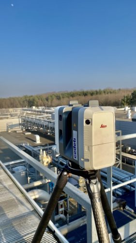
3D Laser Scanning

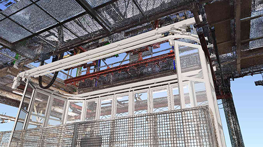
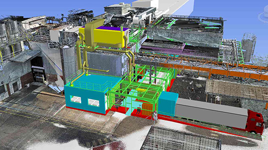
Our Leica 3D laser scanner surveys the existing environment on site as a dense point cloud. In just a few minutes, millions of points are captured with millimetre-level accuracy and a range of up to 40 m. From the point cloud, it becomes possible to:
  • View the survey in 360° from multiple viewpoints
  • Build a 3D model
  • Extract characteristic lines for 2D views
  • Overlay a new project's 3D model onto the existing environment

The benefits of this method: accurate measurement of existing conditions, ensuring new equipment fits within a complex existing environment. The survey is exhaustive and true to reality — every dimension in the point cloud can be measured, avoiding return site visits (for a production area or a hard-to-access zone, for example). It's a contactless survey method, including for hazardous areas.
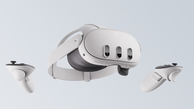
Virtual Reality

We can offer project review sessions in virtual reality. Among other things, these reviews help to:

  • Improve communication within the project team, giving everyone a shared understanding and vision of the project
  • Identify and avoid safety risks
  • Anticipate the risk of defects
  • Fine-tune technical details

BIM Model Management

  • Digital model coordination
  • Clash detection management (BCF files)
  • Collaborative online platform for tracking and viewing models

Have a project for us?

A project in the Grand-Est region, elsewhere in France, in Europe, or internationally? Our team is ready to help.